Multiple Kiwis recommended The Catlins, part of the Southern Scenic Route themed highway, as a ‘hidden gem’ in New Zealand. A place a bit more off-the-beaten path but well worth visiting.
Table of Contents
An Introduction to the Southern Scenic Route
The Southern Scenic Route is a themed highway in New Zealand that follows the coast from Dunedin to Queenstown via Invercargill and Te Anau. The route covers 810 km over 11 hours of drive time.
TIP: All of the sixteen themed highways in New Zealand can be found on our trip map located in the New Zealand planning and resources post. Visualizing these routes on a map was extremely helpful in planning our itinerary.
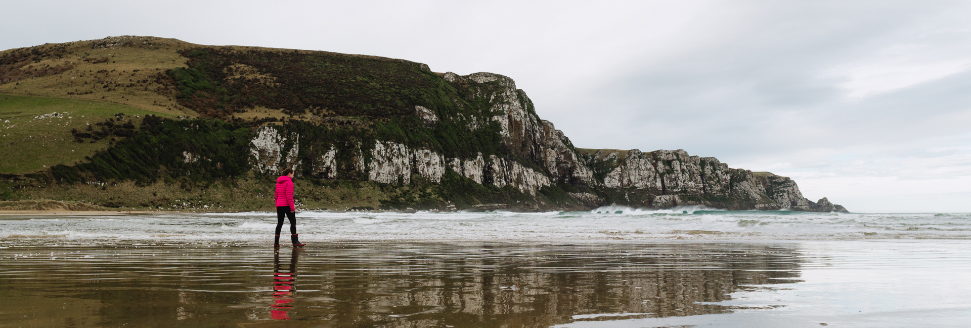
An Introduction to The Catlins
The Catlins covers the stretch of coast between Balclutha and Invercargill. The region is often described as rugged and untouched. The landscape includes beaches, bays, and waterfalls, as well as native forests, caves, and lighthouses.
The Catlins Itinerary
Spending a long weekend or a holiday in The Catlins? Here’s an itinerary to help you identify how you might spend your days.
NOTE: Visiting Cathedral Caves and Curio Bay are tide dependent. These activities are ideal for Day 3 and Day 4 respectively but it is very do-able to swap them and backtrack as needed. We had to do that – no biggie!
Day 1
Day 1 Activities
Your holiday will likely begin in the Dunedin area. If you have the time, explore Dunedin or the Otago Peninsula.
Dunedin is 1 hour from Balclutha and 1 hour 15 minutes from Kaka Point which is where we will start our Catlins adventure tomorrow. So, consider driving towards The Catlins today to position yourself.
Day 1 Campsites
- Riverside Motor Camp & Cafe, Kaitangata – this paid campground is a nice way to start your holiday. There’s powered sites, showers, kitchen, washing machine, and wifi. Added bonus: pizzas are baked on-site and are delicious. The Riverside Motor Camp & Cafe is about 25 minutes from Kaka Point.
- Kaka Point Camping Ground – we’ve never stayed here but it’s a well reviewed campground and a great location!
- Owaka Freedom Camping Site, Owaka – a freedom camping option 20 minutes from Kaka Point.
- Ocean View Recreation Reserve, Dunedin – this beach-side freedom camping spot is an option if you’re not able to get out of Dunedin. However, you’ll have to drive 1 hour and 15 minutes to Kaka Point in the morning.
Day 2

Day 2 includes a wide variety to give you a little taste of everything The Catlins has to offer. Early on we have spectacular views followed by beautiful beaches, a small waterfall, a quirky roadside attraction, a coastal surprise, and a breathtaking campsite.
NOTE: Drive time from Kaka Point to Purakaunui Bay DOC Campsite, with waypoints as outlined below, is approximately 2 hours. This does not account for the amount of time spent at each location.
Day 2 Activities
- Kaka Point
An optional stop, Kaka Point is home to a sandy beach and a popular surf spot. There’s also a 45 minute (1.6 km loop) bush walk located downtown at the Kaka Point Scenic Reserve.
- Roaring Bay – 20 min return
Stop off on the drive up to Nugget Point if it is still early morning. There’s a hide in which to sit and keep watch for yellow-eyed penguins. The yellow-eyed penguins are most likely to be seen early in the morning or late afternoon/sunset.
- Nugget Point – 20 min return
The iconic landscape from The Catlins is photographed from the cliffs at Nugget Point. The nuggets got their name because Captain Cook believed them to look like pieces of gold. Walk down to the Tokata lighthouse and viewing platform to enjoy the views out to sea and below. You are likely to spot fur seals, spoonbills, gannets, and maybe even Hector’s dolphins!
- Cannibal Bay & Surat Bay
Start at Cannibal Bay and, so long as it isn’t high tide, follow the marked walkway through the dunes that connects Cannibal Bay with Surat Bay.
NOTE: At high tide, the only access to Surat Bay is via a 10 minute marked route through sand dunes starting at the end of Surat Bay Road in Newhaven.
Both bays have beautiful beaches. If the weather is nice, stay a while and enjoy! Keep an eye out for sea lions as well.
- Barrs Falls, Barrs Falls Scenic Reserve – 10 min return
A quick stop at our first – and smallest – waterfall in The Catlins! A short descent through native forest will lead you to Barrs Falls.
- Teapot Land, Owaka
It will be impossible to keep driving past all the teapots. You’ll see. Depending on your interest, stop for a quick peek or a chat with the owner.
- Jacks Blowhole Track, Tunnel Rocks Scenic Reserve – 1 hr return
The track to Jacks Blowhole is 20-30 minutes (1.5 km) each way.
The blowhole is unique because it is 200m inland from the ocean and, from above, it appears fully enclosed. The trail circles the blowhole but when we visited there was really only one spot with a good view.
Day 2 Campsite
- Purakaunui Bay DOC Campsite, Purakaunui Scenic Reserve – bookings are newly required at this standard DOC campsite. We’ve stayed here multiple times. It’s a gorgeous location with cliffs and a nearby surf beach. The road down to the bay – and the campsites – can be muddy and slippery after rain.
Day 3

We start Day 3 with more waterfalls, move on to a not-to-miss roadside attraction, continue on with a few short tramps and views, and end the day at Cathedral Caves.
TIP: Before starting out, check the tide-dependent opening times for Cathedral Caves here. If it’s possible to visit the caves during the afternoon/evening today then you’re in luck! Simply follow the itinerary as outlined. Otherwise, consider the alternate plan as noted below.
NOTE: Drive time from Purakaunui Bay DOC Campsite to The Whistling Frog, with waypoints as outlined below, is approximately 1 hour 15 minutes. This does not account for the amount of time spent at each location.
Day 3 Activities
- Purakaunui Falls Walk – 10-20 min
Purakaunui Falls is an iconic Otago waterfall with three tiers. The top viewing platform is wheelchair accessible but the view of the three tiers is located beyond the accessible walkway.
- Matai Falls + Horseshoe Falls, Table Hill Scenic Reserve – 40 min return
The walk to the falls is 20 minutes (1.2 km) each way.
This is a popular walk through forest to two waterfalls. Matai Falls is 10m and is viewed from a platform at stream level. Horseshoe Falls is accessed from the steeper spur track.
- The Lost Gypsy Gallery, Papatowai
This automata gallery is not to be missed! There are lots of unique winding devices made from found objects as well as other funky interactive experiences. Wander the grounds (for hours!) and grab a coffee.
TIP: Get fuel in Papatowai. The only other station before Invercargill is in Tokanui.
- Picnic Point Walkway + King’s Rock, Papatowai – 1 hr return
If you’re short on time, this is the activity to skip.
Start at the bush side of the Picnic Point Walkway. A junction will mark the King’s Rock extension. Take this 40 minute return detour to view seascapes and the toppled pinnacle – King’s Rock. Once back on the Picnic Point section of the walk, continue down to the shoreline to return via the beach.
- Florence Hill Lookout, Papatowai
This roadside pull-out is a great spot to stop for a picnic lunch and take a photo of Tautuku Bay. The beach can be accessed via the gravel road and is popular with surfers.
- Lake Wilkie Track, Tautuku – 30 min return
The Lake Wilkie Track is an interpretive track just south of the Outdoor Education Center. The interpretation panels cover the history of the lake’s formation and subsequent plant life.
TIP: In close vicinity to Lake Wilkie Track are two other short walks. Tautuku Bay (15 min return) is opposite the Outdoor Education Center before the Lake Wilkie Track. Tautuku Estuary Boardwalk (30 min return) is near the Forest and Bird Society Lodge.
- McLean Falls Walk – 40 min return
The highest falls in The Catlins, McLean Falls is 22m tall. Follow the ~1km track slightly uphill and return via the same track.
TIP: The McLean Falls Walk and visit to Cathedral Caves can easily be swapped based on the Cathedral Caves tide-dependent opening times. And, if you have some time to spare, The Whistling Frog Cafe & Bar located at the McLean Falls turn-off has a nice cafe and is a good place to stop for a drink. Note that the adjoining Whistling Frog Resort is one of our camping/lodging options for tonight.
- Cathedral Caves – 1 hr return + viewing time
REMINDER: There is a small window of time each day between late October and May when the Cathedral Caves are open for visiting. This visiting window is approximately 1-2 hours on either side of low tide when low tide coincides during daylight hours. Check the tide-dependent opening times for Cathedral Caves here.
Cathedral Caves are unique because they are lengthy sandstone (opposed to limestone) sea caves. Together they measure 200m in length and have a height up to 30m.
The walk to the caves takes approximately 30 minutes each way. The first 20 minutes of the walk is 980m downhill through forest and the remaining 10 minutes is on the beach. Plan to spend at least 30 minutes viewing the caves.
Be prepared to get your feet wet and consider bringing a torch to light the darker corners of the caves.
The cost to visit the caves is 10 NZD per adult and 2 NZD per child.
Day 3 Campsites
- Whistling Frog Resort, Owaka – if you’re ready to call it a day, this paid resort is a convenient option and has on-site dining.
- Waikawa Recreation Reserve, Waikawa – if you’ve got more in you, this freedom camping spot is another 30 minutes down the road. Note that the first two stops on the Day 4 itinerary are between Cathedral Caves and Waikawa Recreation Reserve if you have extra time and energy. Otherwise you’ll backtrack slightly tomorrow.
Day 4

We start Day 4 with a picturesque waterfall and stop for a laugh before heading to a beautiful beach and petrified forest floor. We wind up the day visiting the southernmost point of the South Island and a nearby lighthouse.
NOTE: Drive time from The Whistling Frog to Waipapa Point & Lighthouse, with waypoints as outlined below, is approximately 1 hour 15 minutes. This does not account for the amount of time spent at each location.
TIP: Before starting out, check the tide table for Curio Bay here. One of the highlights of Curio Bay is only visible for ~4 hours on either side of low tide. The Day 4 itinerary will have you at Curio Bay approximately 2 hours after you get started. If this works out, great! Otherwise, you’ll have to do a bit of backtracking but it won’t be more than 30 minutes.
Day 4 Activities
- Koropuku Falls – 40 min return
This waterfall was my favorite of all The Catlins waterfalls!
Koropuku Falls is a 10m curtain waterfall that’s absolutely picturesque. The walk to the falls begins by crossing a stream on a footbridge and ends with a rocky scramble. Along the way you’re surrounded by moss and boulders. It’s like a scene out of a fairy tale.
- Niagara Falls
This is a brief stop for a laugh.
Niagara Falls was named ironically after the powerful high-flow Niagara Falls located on the USA / Canada border because, as you’ll see, this is the smallest falls in The Catlins. In fact, it’s more like tiny rapids.
- Porpoise Bay
An optional stop, Porpoise Bay – between Waikawa and Curio Bay – is popular with swimmers and surfers of all skill levels. Our itinerary has enough time allocated for you to stop and enjoy the beach if you wish.
- Curio Bay
REMINDER: Check the tide table here.
For four hours on either side of low tide, Curio Bay reveals a petrified fossil forest on its floor. Millions of years ago a forest existed in this location that was destroyed by a volcanic eruption. This then happened again and again. We are able to discern this because the forest regrowth and subsequent volcanic activity left behind fossilized evidence that can be seen on the floor of the bay. Curio Bay is only one of three accessible fossil forests of this type in the world!
In addition to the marvelous petrified fossil forest floor, Curio Bay is home to a colony of yellow-eyed penguins as well as a pod of Hector’s dolphins. The penguins are most likely to be spotted an hour or so before sunset.
- Slope Point – 40 min return
The walk to Slope Point is 20 minutes each way via private farmland.
Slope Point is the southernmost point on the South Island of New Zealand. That’s kinda a big deal in my book. Yellow signs mark the spot and list distances to various locations, including the equator and the south pole.
- Waipapa Point & Lighthouse
This wooden lighthouse is located near beautiful beaches that often are home to sea lions. In addition, there are interpretive panels that tell the story of the lighthouse and its construction. In short, it was built in response to a horrible shipwreck that occurred in 1881 killing 131 people onboard.
TIP: Our Day 4 itinerary officially ends here but you may wish to return to Curio Bay to see if you can spot any yellow-eyed penguins at sundown. Or, perhaps you want to spend some more time on the beach at Porpoise Bay.
Day 4 Campsites
- Fortrose A/Moray Terrace Reserve Freedom Camping, Fortrose – 15 minutes further down the road from Waipapa Point, this is an open field adjacent to the water. We’ve stayed here multiple times. It can get quite windy but has great views.
- Haldane/Weirs Beach Freedom Camping, Slope Point – located closer to Slope Point, we’ve stayed here but recent discussions have considered removing this as a freedom camping location so check current regulations.
- Monkey Island Beach Freedom Camping, Orepuki – located 1 hour 45 minutes from Waipapa Point, you’ll travel through Invercargill to access this freedom campsite. A nice option if you want to stop in town for dinner or supplies, or simply to eliminate the drive time from the bonus Day 5 itinerary add-on.
The Catlins Itinerary Add-Ons
The Catlins region officially extends from Balclutha to Invercargill. But while we’re this far south, why not experience even more?!
Day 5 (a.k.a. Glowworm Bonus Day)

Here’s a Day 5 itinerary as a bonus day. You’re welcome.
NOTE: Drive time from Fortrose A/Moray Terrace Reserve Freedom Camping to Clifden Suspension Bridge, with waypoints as outlined below, is approximately 2 hours. This does not account for the amount of time spent at each location.
Day 5 Activities
- Gemstone Beach, Orepuki
This is a fun stop. Spend time wandering the beach and admiring the abundance of colorful and unique gems and rocks that cover the shore.
- McCracken’s Rest and Lookout, Te Waewae
If you drove from Fortrose this may be the perfect picnic lunch spot. Sit and enjoy the view of Te Waewae Bay while keeping an eye out for Hector’s dolphins. And, of course, snap a photo in front of the yellow sign / distance posts.
- Clifden Caves, Clifden – 2 hrs return
The Clifden Caves are managed by the DOC. They are limestone caves and, quite literally, brightened our day: glowworms can be seen twinkling inside the caves!
The caves have an upper and lower entrance point and, in good weather, can be traversed from one side to the other. Orange markers denote the route. We ended up having to turn back after making it almost to the end because there was a deep pool of water that we weren’t interested in swimming or wading through.
We thoroughly enjoyed exploring the caves and watching the glowworms!
Day 5 Campsite
- Clifden Suspension Bridge, Clifden – this freedom camping location is a gravel lot with a new toilet facility. A suspension bridge is located here as well.
TIP: The Clifden Suspension Bridge is 45 minutes from Manapouri and might be your best option for freedom camping when visiting Doubtful Sound or other Manapouri attractions.
Add-On Option #1: Rakiura Track + Stewart (Rakiura) Island
Stewart Island is accessible from Bluff via ferry or Invercargill via air. It is well-worth a visit. We highly recommend adding this as a multi-day detour on this itinerary. Read more about our time in Stewart Island and on the Rakiura Track / Great Walk here.
Add-On Option #2: Hump Ridge Track
The Hump Ridge Track has been selected as the next Great Walk in New Zealand. It is expected to don the Great Walk status in 2022, making the Hump Ridge Track the 11th Great Walk. However, this stunning (and luxurious) walk can be enjoyed independently or with a tour group now.
New Zealand Planning and Resources
If you’re planning for your vacation or holiday in New Zealand, more resources – including our trip map with points of interest and camping spots – can be found in our New Zealand planning and resources post.
Our travelogue and the details of our day-to-day activities can be found in our New Zealand itinerary and travelogue post.
travel dates: February 8 – 14, 2020 & August 19 – 21 & 25 – 26, 2020
last updated: 29-Jun-2021